Why Utility Locating Services Are Critical for Modern Infrastructure Projects
- DreamDen AI Editorial Team
- Sep 20, 2025
- 5 min read

Utility strikes impact thousands of projects across the United States every year, leading to injuries, costly property damage, and in some cases, even loss of life. All it takes is one unidentified utility line to bring progress to a standstill. With rapid urban expansion and aging infrastructure, managing what lies beneath the surface has become increasingly complex.
Traditional utility locating methods often fall short, proving both time-consuming and prone to errors. These limitations can cause delays, increase expenses, and create significant safety hazards. Today, however, digital mapping tools are transforming the way utility infrastructure is managed.
This article explores why underground utility locating services are essential to modern construction. By identifying hidden risks before work begins, project teams can safeguard workers, control costs, and remain compliant with industry regulations.
Why Underground Utility Locating Services Are a First Step in Infrastructure Projects
America's infrastructure relies on over 20 million miles of underground utilities that connect power, water, and communication services to homes and businesses nationwide. This network is so big that underground utility locating becomes the first crucial step in any infrastructure project.
Why Underground Utility Locating Services Are a First Step in Modern Infrastructure Projects
Preventing Accidental Strikes on Gas and Power Lines
Hitting buried utilities leads to severe and life-threatening consequences. Excavation damage to underground facilities remains one of the biggest safety risks in industrial services across the United States. Workers hit utilities nearly 200,000 times each year, which disrupts essential services and puts both workers and the public at risk.
Construction crews that accidentally hit gas pipes or electrical cables face catastrophic results:
● Gas line strikes can trigger explosions and fires
● Electrical line damage risks fatal electrocution
● Water main breaks cause flooding and soil instability
● Sewer line impacts lead to environmental contamination
These damages cost more than $30 billion nationwide each year. Other estimates put the cost at $15 billion annually, which equals over 300 strikes per day. The good news is that proper subsurface utility engineering practices can prevent 80% of utility damage.
Reducing Project Delays from Unknown Subsurface Hazards
Unknown underground utilities create major project risks beyond safety concerns. Construction stops immediately when workers find unexpected subsurface conditions. These stops lead to schedule delays and budget overruns that can make projects unfeasible.
Ground and subsurface conditions change unpredictably, even within short distances. These unknowns then dramatically affect project costs and schedules.
The numbers tell the story - getting a private utility survey beforehand saves 91.2% in overall project expenses. Research shows that subsurface utility engineering services give returns ranging from 4:1 to over 20:1.
My experience shows that accurate underground utility mapping helps designers avoid utility conflicts during the design phase. This eliminates costly field changes and reduces construction delays. Projects run smoother and stay compliant with regulations as a result.
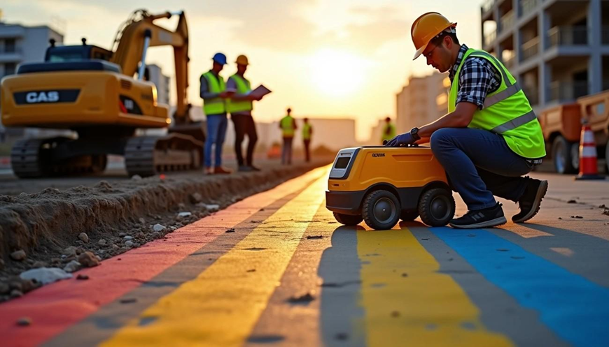
How Ground Penetrating Radar and GPS Mapping Improve Accuracy
Image Source: UtiliSource
Technology today has improved the accuracy of underground utility detection. Non-destructive investigation methods now protect infrastructure and workers better than before. These advances have made utility locating services more reliable and effective.
GPR Imaging for Non-Invasive Subsurface Detection
Ground Penetrating Radar (GPR) transmits high-frequency radio waves into the ground. The system analyzes signals that bounce back when they hit different materials. This technology creates up-to-the-minute images of buried structures without surface disruption. GPR outperforms traditional methods by detecting:
● Both metallic and non-metallic pipes, including plastic water and gas lines
● Continuous plastic conduits that electromagnetic locators miss
● Voids, reinforcement structures, and subsurface anomalies
GPR's safety makes it valuable because it emits only 1% of a cell phone's output signal. The technology has replaced x-ray scanning as the top choice for precision detection.
GPS Utility Mapping for Centimeter-Level Precision
GPS technology integration with private utility locating services from BHUG has achieved unmatched accuracy in mapping underground infrastructure. Modern GPS-enabled utility maps can locate underground assets within centimeters. This level of precision represents a big improvement over older methods. Real-Time Kinematic (RTK) GPS delivers centimeter-level accuracy 95% of the time, even in tough conditions.
Precise measurements are vital since a few inches of error can lead to utility line damage. GPS utility mapping combines various detection methods with geospatial coordinates.
Overlaying Utility Data on GIS Platforms
Geographic Information Systems (GIS) reshape collected utility data into interactive, layered maps with unprecedented visualization capabilities. Modern locators with GPS and GIS features enable precise mapping and digital documentation.
This integration provides several benefits:
● Users can view utilities instantly among other geospatial data
● Stakeholders share data quickly through cloud platforms
● Teams can map and document previously unknown utilities
GIS integration helps utility locating services deliver 99.8% accurate field-verified utility maps. Specialized software platforms make these maps available minutes after job completion.
Integrating Utility Locating into Civil Engineering Workflows
Image Source: ASCE
The success of modern infrastructure projects increasingly relies on how effectively teams integrate utility locating data into every stage of the civil engineering process. From permitting to foundation planning and execution, accurate information about underground infrastructure transforms how projects are designed and delivered.
Key applications include:
● Utility mapping for permitting and design: Engineers and architects can create more realistic plans when they have precise data on existing utilities. Many municipalities now require verified maps before granting construction permits, ensuring designs account for subsurface conditions from the start.
● Subsurface investigations for foundation planning: Professional investigations reveal soil conditions and underground risks that could affect foundation design. By identifying potential challenges early, teams avoid costly redesigns and build with greater confidence.
● Data sharing across project teams: Utility maps can be shared in accessible formats like KMZ files, giving surveyors, engineers, and contractors a clear understanding of existing infrastructure. Consistent communication and data transparency reduce missteps and improve coordination on excavation and construction decisions.
Long-Term Benefits for Smarter and Safer Infrastructure
Professional utility locating services deliver advantages that extend well beyond the initial construction phase. By creating accurate records and applying modern technology, they support the entire lifecycle of infrastructure while reducing risks and costs.
Key long-term benefits include:
● Lower maintenance expenses: Accurate utility maps improve asset management and reduce reliance on costly emergency repairs. Preventive maintenance costs significantly less than reactive fixes, and detailed records help teams prioritize equipment replacement before failures occur.
● Sustainable excavation practices: Precision locating minimizes soil disruption and helps preserve natural ecosystems. Ground-penetrating radar enables non-invasive detection, cutting down on waste and lowering the overall carbon footprint of construction projects.
● Enhanced safety and compliance: GPS-based mapping provides verifiable documentation of utility locations, helping companies meet regulatory requirements and secure permits more efficiently. Accurate records also assist emergency responders, reducing the risk of accidents and costly utility strikes.
● Greater project efficiency: Reliable underground data shortens planning timelines and reduces delays caused by unexpected discoveries. With clear utility records, teams can coordinate more effectively, streamline workflows, and complete projects on schedule.
Conclusion
Modern infrastructure depends on knowing exactly what lies beneath the surface. When underground data is missing or inaccurate, projects face costly delays, safety hazards, and in some cases, life-threatening incidents. The scale of risk is immense, yet it can be managed effectively through careful planning and the use of advanced locating methods.
Technologies such as ground penetrating radar, GPS mapping, and GIS integration now provide a level of precision that was once out of reach. With accurate records and clear utility data, project teams can plan more effectively, avoid conflicts, and reduce the chance of unexpected disruptions.
Utility locating services are no longer just a precautionary measure. They have become an essential part of the infrastructure lifecycle, protecting workers, saving money, and ensuring compliance with regulations.


Comments